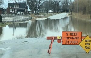
It could be late tonight or tomorrow morning before the Thames River peaks in the Chatham area.

The Lower Thames Valley Conservation Authority says water levels upstream in Elgin and Middlesex County are dropping, but flood waters in the city are expected to rise another 50 cm to 1 m by the time the peak passes through the city.
Current predictions suggest water levels could reach those similar to the flooding that occurred in 1982.
Meantime, the St Clair Region Conservation Authority has extended its flood warning with some flooding in Wallaceburg and around the watershed.
The gates of the McKeough Dam remain closed and water continues to be diverted as levels in Wallaceburg have not reached the conditions necessary to initiate opening the gates.
A number of roads are impacted due to flooding:
- Tefler Road between Courtright Line and Moore Line
- Stanley Line between Kimball Road and Waubuno Road
- Indian Creek Road between Bentpath Line and Wilkesport Line
- Duthill Road between Holt Line and Smith Line
- Waubuno Road between Bickford Line and Tennyson Line
- Waterworks Road north of Courtright Line


