

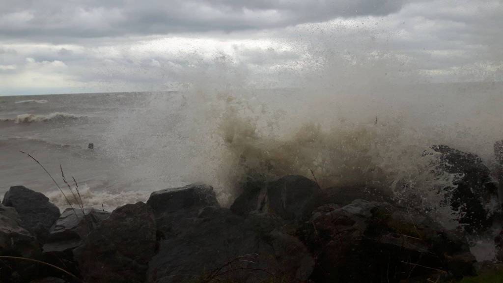
 There is a Strong Wind Warning in effect for western Lake Erie. Winds across the region are currently light and from the southwest. Forecasts predict that winds will rise throughout the day and that sustained wind speeds above 35 km/hr will be reached this evening. Peak sustained wind speeds this evening or overnight could range from 35 to 45 km/hr. While most forecasts are predicting winds will drop off by early tomorrow morning, some forecasts suggest that sustained wind speeds might remain above 30 km/hr throughout Sunday morning. Wave forecasts for Lake Erie suggest waves could reach 1.5 to 2 m in height overnight. There is also a risk of thunderstorms during this period.
Given current Lake Erie water levels and the predicted wind speeds, there is a risk of flooding and shoreline damage along Erie Shore Drive in Chatham-Kent during this wind event. There is also some risk to other low-lying shoreline areas in Chatham-Kent and Elgin County.
Due to high lake levels, there is also a risk that wave action could damage shoreline protection works and cause erosion all along the Lake Erie shoreline in Chatham-Kent and Elgin County, including along the high bluff areas.
Currently, winds are not predicted to be from a direction that would cause issues for the Lake St. Clair shoreline in the LTVCA jurisdiction.
People should take extra caution and avoid the shoreline should conditions get rough. The waves can be strong and the shoreline slippery. There could also be hazardous debris within the waves and water which could be thrown onto the shore. Standing water can also present unseen hazards. Children and animals should be kept away from the water.
Officials will continue to monitor the situation and update this advisory if necessary.
Flood watch effect until May 3, 2021.