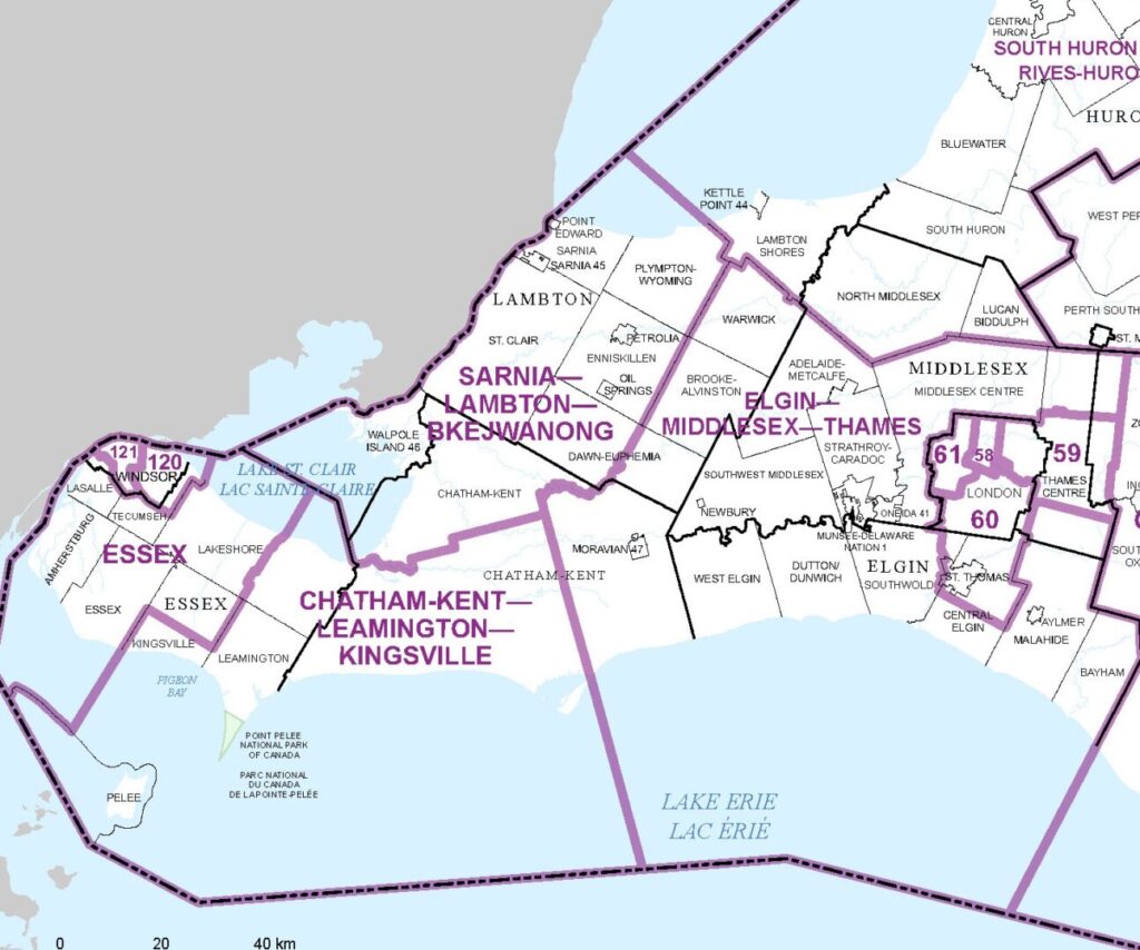
The ridings representing Chatham-Kent and the surrounding area may look very different during the next federal election.
The Federal Electoral Boundaries Commission for Ontario is proposing sweeping changes to the current electoral map that will effectively split the municipality of Chatham-Kent into three different federal ridings. The current proposal would also see the riding of Lambton-Kent-Middlesex split up and absorbed into neighbouring ridings.
The commission has proposed expanding the riding of Chatham-Kent-Leamington west to include Kingsville and north to include Pain Court, Kent Bridge, and Louisville. However, to the east, Ridgetown and the areas of Morpeth, Highgate and Clachan would no longer be part of the riding. If approved, the name of the riding would change to Chatham-Kent-Leamington-Kingsville.
The most significant change to the area’s ridings would be the dissolution of Lambton-Kent-Middlesex and the expansion of neighbouring districts.
The Sarnia-Lambton riding would expand to include Walpole Island, Wallaceburg, Dresden, and Rutherford. The proposed name for the new riding is Sarnia-Lambton-Bkejwanong.
The remaining parts of the Lambton-Kent-Middlesex would be split between two other new ridings — South Huron Shores to the north and Elgin-Middlesex-Thames to the east.
Ridgetown, Morpeth, Highgate, Clachan, Thamesville and Bothwell would also be included in the new riding of Elgin-Middlesex-Thames.
The Federal Electoral Boundaries Commission said its proposal reflects the increase in Ontario’s population between 2011 to 2021, as captured in the 2021 Census. The commission also takes into consideration communities of interest or identity, and historic and geographic factors.
The changes to the ridings will be up for consideration at 17 public hearings that will take place between September 26 and October 29.
The earliest the new boundary map could be approved is in April of 2024, before coming into effect on the subsequent dissolution of Parliament.
For more information about the proposed changes to Ontario’s federal ridings, click here.


