
Another step forward in the municipality’s plans to revitalize Wallaceburg’s South Side.
An online survey has been launched to gather more public feedback about what residents would like to see in the area south of the Sydenham River.
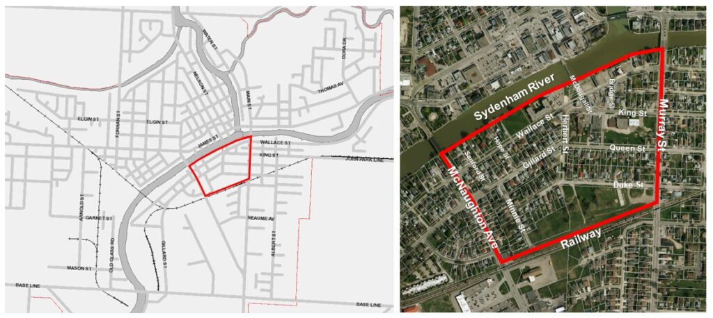
The Secondary Plan for Wallaceburg’s south side is meant to encourage the gradual transition of new land uses over time through reinvestment in the neighbourhood by stakeholders from the private, public, and non-profit sectors.
The area to be included in the Secondary Plan includes lands south of the Sydenham River, west of Murray Street, north of the railway corridor, and east of Herbert Street; and lands south of King Street and east of Minnie Street.
The survey, which can be found on the Let’s Talk Chatham-Kent website, is open until April 29th.
Following this round of public input, municipal officials plan to hold a workshop and walkabout in the spring to discuss land use and development options.