
Local residents are being asked to review an environmental assessment, which details Chatham-Kent’s plan to relocate a section of Talbot Trail between Wheatley and Erieau.
The Municipality of Chatham-Kent said the Class Environmental Assessment Study recommends constructing a new two-lane arterial roadway in order to relocate Talbot Trail to the 2nd Concession Line, from Ellerbeck Road to Stevenson Road.
“The EA Study has evaluated alternatives for alignment, cross sections, intersections, and active transportation to develop a recommended plan to address the needs within the study area,” the municipality said in a news release.
As well, local access roads and driveway extensions will be constructed as required to service residents if Talbot Trail is affected by closures due to coastal erosion in the future.
Chatham-Kent Council approved the plan and the environmental assessment during a meeting on January 16.
“The recommended plan highlighted in the Environmental Study Report (ESR) is following the direction Council provided at the January 16 meeting. The ESR recommends to move ahead with Phase 1, which is the implementation of a new 2-lane arterial roadway in order to relocate Talbot Trail to the 2nd Concession Line, from Ellerbeck Road to Stevenson Road,” explains Chris Thibert, Chatham-Kent’s Director of Engineering. “Phase 2, which was from Stevenson Road, to East of County Road 12 is described in the ESR for information only, however there are no recommendations for road realignment provided for this phase, as per Council direction.”
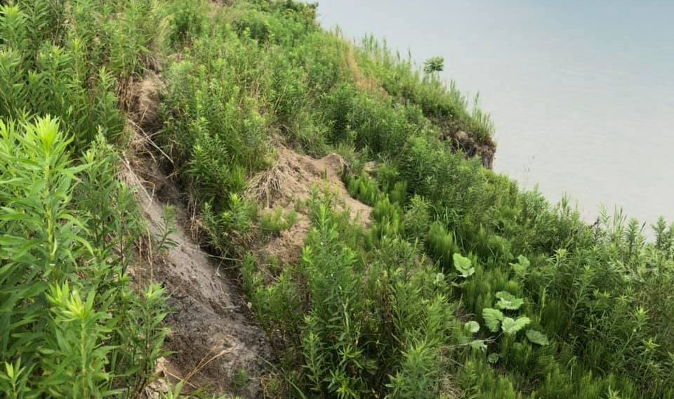
Talbot Trail has been plagued by coastal erosion from Lake Erie in recent years. In 2019, the municipality was forced to close a section of Talbot Trail near Coatsworth after the road sustained damage to its structural integrity.
The environmental assessment will be available for review on the Let’s Talk Chatham-Kent website and at the Civic Centre in Chatham until May 30.